uk3peaks.com
uk3peaks.com |
You will need to sort out your route and ensure that your drivers know exactly where they are going, where they need to drop you off, and what the schedule is for the 24 hours. Most of the route is fairly straightforward with no real decisions to be made on which particular roads to take.
I have puts links to the instructions we will use for our attempt and you are free to print them out and use them. However, do not re-distribute them or try and pass them off as your own work. The instructions are in pdf format and you can download Adobe Acrobat here
There are a few exceptions for this and I have set them out below.
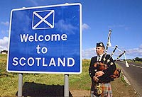
The start of the challenge is usually from Glen Nevis Visitors Centre(PH33 6PF, or NN 12288 73072). There is plenty of parking here and so you can take your time sorting things out and getting ready to go and start the clock.
A less popular alternate start is from the Glen Nevis Youth HostelOnce you have finished, head back to the A82 and head south.
When you get to Crainlarich you have the choice of heading along Loch Lomond and in to Glasgow via the A82, or turning left and going along the A85/A84 towards Stirling. The A82 route is marginally shorter, but not recommended as the road is very narrow and twisty. You also have to go through Glasgow at the end of it which, depending on your schedule, may be during busy traffic periods.
The route I have done is via the A85/A84 towards Stirling. The road is easier to drive and will probably allow the walkers to get more sleep as they won't be tossed around.
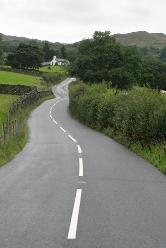
The only other decision is tied in to which approach you want to take towards Scafell Pike. Most people start from Wasdale Head, but you can start from Seathwaite. Seathwaite is easier to get to and will probably save you between 30 minutes and an hour on the first leg. However, the route from Seathwaite to Scafell Pike is longer and will probably take you 30 minutes to an hour longer so overall you probably will gain very little if anything. Personally I would rather have an hour less walking and an hour more driving, especially if it is 4am.
No real debate on the route here, except for your final approach to Pen-y-Pass from the A55. Looking at a map you would think that coming off on to the A548 or A470 and heading towards Betws-y-coed to approach from the east seems the quickest and most direct route. DON'T DO IT. On a practice walk up Snowdon we came back that way and it was at least 30 minutes slower than the route I have planned for. The roads are slow, you have to pass through many villages with 30mph speed limits, and there is a lot of tourist traffic on single lane roads.
The better way, and the way we drove to Snowdon for our practice walk, is to stay on the A55 until J11 near Bangor, then approach via the A4244 and A4086 though Llanberis. The A55 is a duel carriageway with a 70mph speed limit. It is a quicker route and much easier to drive.
Service Stations
I have listed all the motorway services you will pass below. There are also services along the A82 and A84 in Scotland, the A595 and A590 in Cumbria, and on the A55 in North Wales. However, many of these are not open 24 hours and therefore you should not rely on them being open.
M9 & M80
Stirling Services at M9-M80 junction
M74 Services
Bothwell Services (Southbound only) between J4-5
Hamilton Services (Northbound only) between J5-6
Happendon Services between J11-12
Abington Services J13
A74(M) Services
Annandale Water Services J16
Gretna Green Services between J21-22
A74 Services
Todhills Services between the end of A74(M) J22 and M6 J44
M6 Services
Soutwaite Services between J42-41
Tebay Services between J39-38
Burton-in-Kendal Services (Northbound only) between J36-35
Lancaster Services between J33-32
Charnock Richard Services between J28-27
Lymm Services at M6 J20-M56 J9 junction
M56 Services
Chester Services J14
We plan to be farily flexible with our stops. We know where all the services are so we can choose to stop as necessary.
For a full list of motorway services see the links below:
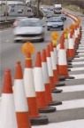
It is also worthwile to have a look at information online about current or planned roadworks along your route to prevent any surprises on the day. If there are roadworks you should make sure that your drivers are fully aware of where they are, and whether you need to consider an alternate route to avoid them.
For up-to-date travel news you can try the BBC travel news
For an up-to-date list of speed cameras these two sites are helpful:
Speed Camera Map
Speed Cameras UK
Transport
With our team of three walkers and 2 drivers we are hiring a 7-seater people carrier for the challenge. If we had more people in the team we would have to hire a 9 seater or 12 seater minibus. You should plan to allow for at least two empty seats whatever you plan to do the challenge in as the walkers will appreciate the room for kit and to stretch out for sleep. A good rule of thumb is:
Team up to 5 - 7 seat people carrier like a Vauxhall Zafira, or better yet a Ford Galaxy which is larger.
Team of 6 to 8 - 9 seat minibus like a Ford Toureno
Team of 9 to 10 - 12 seat minibus
Team of 11 to 14 - 17 seat minibus
WARNING: since 1 January 2008 vehicles with more than 8 passenger seats are speed limited to 62mph. This will apply to the minibuses listed above and will mean you will lose a considerable amount of time as the driving will take longer. Also unless you applied for your provisional licence before 1 January 1997 you will not have category D on your driving licence and will not be able to drive a minibus. This may severely restrict who you can ask to drive.
Roads For most of the driving you will do between the mountains the roads you will use will be motorways or single/duel carriageway A roads. However, when picking you transport you need to ensure that you don’t get anything too big as some of the roads, in particular those from the A595 to Wasdale Head, are very narrow twisty and undulating and not suitable for large vehicles. Even with a small car you would struggle to average much above 20-30mph driving in to and out of Wasdale Head. Realistically, anything larger than a 17 seat minibus is not going to go down these roads, and even a minibus will be difficult work for your drivers.